If you see a ship or boat off the coast and you’re like us, you’ll probably be curious to know what it is, so here’s a live vessel finder map.
Notes
The grey contour line is 12 miles out from the coastline.
Click/tap on a vessel to see a photo of it and more info.
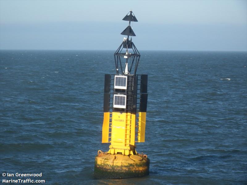
What’s that flashing light on the horizon?
Well, there’s a whole load of activity off the Mundesley coast so it could be anything…but if you see it night after night and it’s not moving (apart from bobbing around), it’s probably this light buoy – N HAISBRO. It’s about 8 miles out to sea, but if you’re on the cliffs and it’s clear, you can see it day or night with an average pair of binoculars or pretty good eyesight.